Home

Galleries

News/Blog

Technology

Media

Bio

Links

So Many Tornadoes...

Dodge City, Kansas - May 24 2016
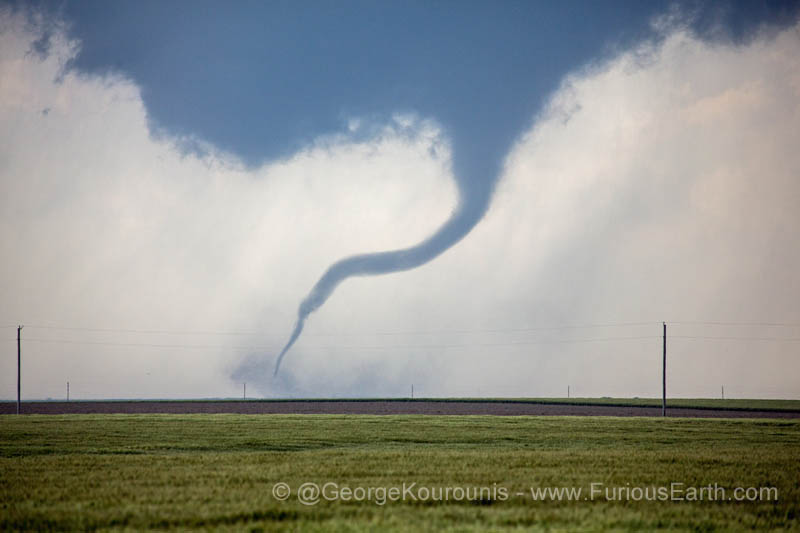
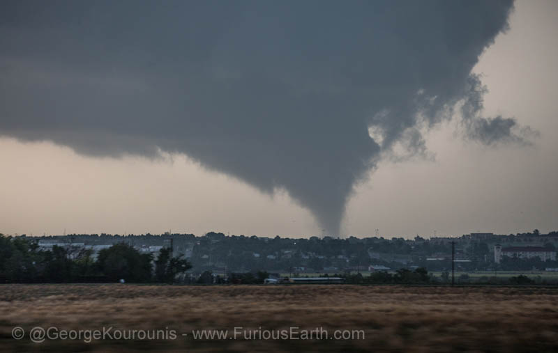
It is very rare to witness a storm that produces SO many tornadoes. We literally lost count of the number as the storm luckily passed just west of Dodge City, Kansas. We believe we witnessed at least 9 tornadoes, possibly more. There were at least two instances when there were two tornadoes on the ground simultaneously, and possibly (pending video review) 3 touching down at the same time.

At one point, we had to backtrack on dirt roads that started off good, but slowly deteriorated to the point where we had to abandon them or risk getting stuck.

The storm just kept on producing tornado after tornado... The strongest was rated EF-3. Here are
pictures of some of the damage near Dodge City.

Dodge_City_01

Dodge_City_02
The first tornado touchdown, not far from the town of Minneola.
A sheathed funnel with debris swirl.

Dodge_City_03

Dodge_City_04
Tornado roping out and getting a snake-like appearance.
The tornado re-forms and becomes quite strong.

Dodge_City_05

Dodge_City_06
Out over open countryside.
A second tornado forms.

Dodge_City_07

Dodge_City_08
Two on the ground at the same time.
The primary tornado strengthens.

Dodge_City_09

Dodge_City_10
More funnels touching down. This is when things start to get complicated and difficult to keep track of.
Tornado roping out.

Dodge_City_11

Dodge_City_12
Now there's a very large, multiple-vortex tornado approaching the town of Dodge City.
And yet again, a secondary tornado forms.

Dodge_City_13

Dodge_City_14
Again... Two simultaneous tornadoes.
The tornado gets very close to Dodge City, and hits the local landfill.

Dodge_City_15

Dodge_City_17
After the storm passes, we are treated to a dazzling display of anti-crepuscular rays.
Sunset in Dodge City, and one of the best displays of mammatus clouds I've ever seen.

Dodge_City_16

Dodge City NWS
The Weather Network team after the storm. Everybody is safe and sound. Time for some margaritas.
Here is a write-up about the event from the National Weather Service office in Dodge City, including tornado tracks and radar loops.

1