Winters are notoriously harsh
in the Yukon and this year there has been a particularly nasty
cold snap that has been lasting for weeks. I traveled to the
region to document the extreme conditions. The coldest I encountered
was -44C (-47F) with a wind chill of -50C (-58F).
I did end up getting some frostbite
on my face. I only had a small area of skin exposed while driving
a snowmobile, but that was all it took.
3.27 PM PST Friday 8 February 2008
Wind chill warning for
Whitehorse continued
Very cold temperatures combined
with gusty northerly winds will produce extreme wind chill values
overnight through Saturday.
This is a warning that extreme wind
chill conditions are expected or occurring in these regions.
Monitor weather conditions..Listen for updated statements.
An extremely cold airmass combined
with northerly winds of 30 to 50 km/h along sections of the south
Klondike highway and Haines Road will continue to produce extreme
wind chill values reaching minus 50 tonight through Saturday
morning. Frostbite can occur in minutes in these conditions.
High pressure over central Yukon
coupled with a low pressure centre tracking to the gulf of Alaska
this evening will give rise to increasing northerly winds. These
winds will combine with the very cold temperatures to foster
extreme wind chill values in the minus 50 to minus 60 range over
regions of southern and central Yukon as well as the far north
including northern Dempster.
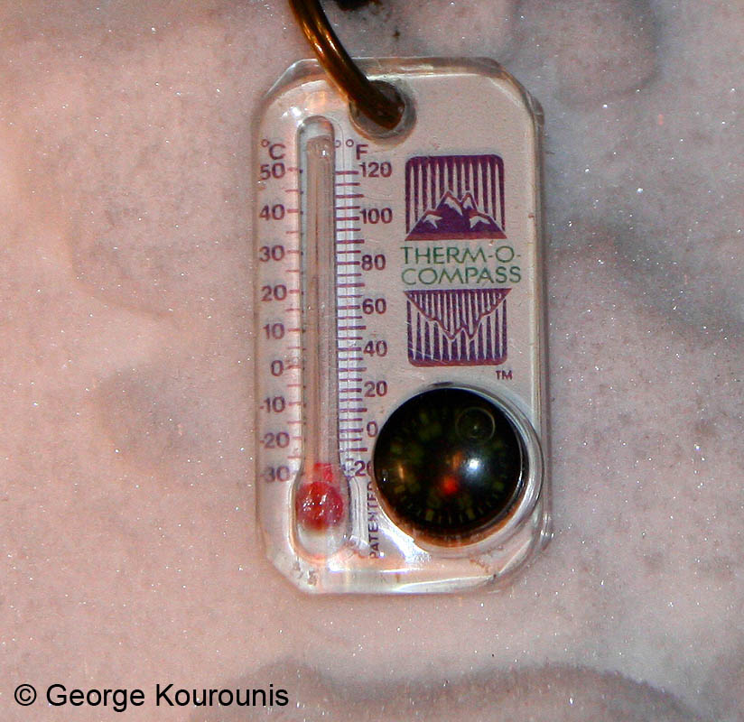
Yep, that's -40... The point
where the Celsius and Fahrenheit scales meet.
It is so cold that throwing
a cup of boiling water into the air causes it to explode into
ice crystals before it hits the ground.
My mini thermometer doesn't
even work in these temperatures.
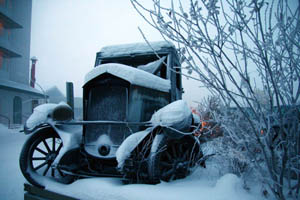
A snowy winter scene in Whitehorse.
It looks beautiful but at -40C,
being outside for too long without the proper clothing can cause
frostbite within minutes.